Metchosin BioBlitz: Maps
To find your way to Metchosin, consult the Google Map.
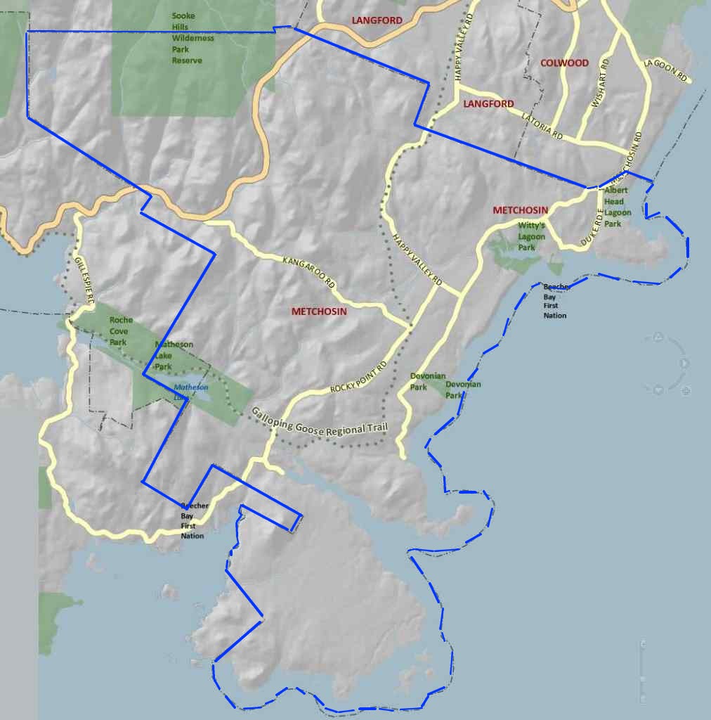
Wondering where the boundaries of Metchosin are? Here is map (click to open in new window/tab) showing the boundaries, taken from the CRD Natural Areas Atlas. See the Atlas itself for more detail.
Many events are at Metchosin District Office, which is behind the firehall.
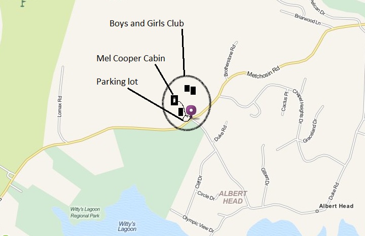
Some BioBlitz forays have started at the Boys and Girls Club. It is located at 3900 Metchosin Road. Here is a map:
Camosun College's
Van der Meer property, the site of some of our surveys, is off of Kangaroo Road. Turn north from off of Kangaroo Road onto Barrow Road. When La Bonne splits from Barrow, take Barrow and continue to the end of Barrow. Here is a map:
View Larger Map
Instructions on how to get to YMCA Camp Thunderbird (and a map).
For Witty's Lagoon and Tower Point maps and instructions see the CRD site for the Parks . The quickest way to Witty's Beach is the access trail at the bottom of Witty's Beach Road (parking allowed at places along the road).
A map of Blinkhorn is in the District of Metchosin Trails Brochure. The Park is on the north side of Kangaroo Road, about halfway between the two ends of the road. Limited parking in a small lot off Kangaroo Road.
Pearson College driving instructions and map. Parking lot on campus.
Access to Weir's Beach is at the end of Sandgate Road (Sandgate intersects Rocky Point Road). A map:
See also the four maps of the regions around the Metchosin schools (Hans Helgesen and Westmont Montessori) that were developed as part of an environmental education initiative for Metchosin youth.